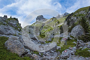
- Stock Photography: SUMMER HIKING IN KOMOVI, MONTENEGRO by Mugurelm
- Price: 1$
- Size Facebook: 1702 x 630 px
- Size Twitter: 1500 x 500 px
- Size LinkedIn: 1128 x 191 px
More Facebook, Twitter and LinkedIn Cover Photos
Cover photo info
- Photo title: Summer hiking in Komovi, Montenegro
- Author: Mugurelm
- Cover photo description:
- Together with DURMITOR range and PROKLETIJE range, KOMOVI range belong to the group of the three most impressive and most magnificent mountain ranges of Montenegro and also of DINARIC ALPS. Komovi range is situated in the eastern part of Montenegro Serbia&Montenegro and it stretches between the farthest upstream parts of the Lim river to the east and the Tara river on the west, to Drcka river to the north and Prokletije with mount Planica to the south. From the south and east it is encircled with a complex of Montenegrin - Albanian mountain range known as Prokletije the highest peaks at altitude of 2534 m - Kolac/Maja Kolata, 2694 m - Jezerski Vrh/Maja Jezerce, and on the north by Bjelasica mountain the highest peak at altitude of 2139 m - Crna Glava/Black Head.
- Image ID:185445050
- Views:0
- Downloads:1
Keywords for Facebook, Twitter and LinkedIn timeline photos
blue
clouds
dinaric
durmitor
eastern
grass
green
hiking
impressive
komovi
landscape
magnificent
montenegro
mountains
nature
people
prokletije
rocks
sky
stones
summer


