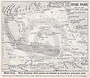
- Stock Photography: VINTAGE MAP OF HYDE PARK 1900S by Mjb6661
- Price: 1$
- Size Facebook: 1702 x 630 px
- Size Twitter: 1500 x 500 px
- Size LinkedIn: 1128 x 191 px
More Facebook, Twitter and LinkedIn Cover Photos
Cover photo info
- Photo title: Vintage map of Hyde Park 1900s
- Author: Mjb6661
- Cover photo description:
- Harmsworth`s Universal Encyclopaedia 1920s - Social History. Plan showing chief points of interest in London`s principal park. Hyde Park is a Grade I-listed major park in Central London. It is the largest of four Royal Parks that form a chain from the entrance of Kensington Palace past the main entrance to Buckingham Palace. The park was established by Henry VIII in 1536 when he took the land from Westminster Abbey and used it as a hunting ground. It opened to the public in 1637 and used for May Day parades. Major improvements occurred in the early 18th century under the direction of Queen Caroline.
- Image ID:204716946
- Views:0
- Downloads:0
Keywords for Facebook, Twitter and LinkedIn timeline photos
1536
1637
18th
1900s
1920s
abbey
buckingham
caroline
central
century
chain
chief
day
direction
early
encyclopaedia
entrance
established
form
four
grade
ground
harmsworths
henry
history
hunting
hyde
improvements
interest
kensington
land
largest
london
londons
main
major
map
may
nplan
occurred
opened
palace
parades
park
parks
past
points
principal
public
queen
royal
showing
social
took
universal
used
viii
vintage
was
westminster


