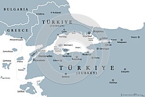
- Stock Photography: BOSPORUS AND DARDANELLES, THE TURKISH STRAITS, GRAY POLITICAL MAP by Peterhermesfurian
- Price: 1$
- Size Facebook: 1702 x 630 px
- Size Twitter: 1500 x 500 px
- Size LinkedIn: 1128 x 191 px
More Facebook, Twitter and LinkedIn Cover Photos
Cover photo info
- Photo title: Bosporus and Dardanelles, the Turkish Straits, gray political map
- Author: Peterhermesfurian
- Cover photo description:
- Bosphorus and Dardanelles, gray political map. The Turkish Straits, internationally significant, narrow waterways in Turkey. Passages, connecting the Aegean Sea and Sea of Marmara with the Black Sea.
- Image ID:249647314
- Views:0
- Downloads:0
Keywords for Facebook, Twitter and LinkedIn timeline photos
aegean
anatolia
asia
atlas
black
bosphorus
bosporus
canakkale
canal
cartography
connection
constantinople
continent
country
dardanelles
eurasia
europe
gallipoli
gelibolu
geography
gray
greece
hellespont
illustration
international
island
istanbul
map
mapping
maritime
marmara
mediterranean
narrow
navigation
passage
peninsula
political
sea
significant
strait
straits
thrace
transportation
travel
turkey
turkish
turkiye
vector
waterway


