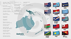
- Stock Photography: THE OCEANIA MAP DIVIDED BY COUNTRIES by Panaceadoll
- Price: 1$
- Size Facebook: 1702 x 630 px
- Size Twitter: 1500 x 500 px
- Size LinkedIn: 1128 x 191 px
More Facebook, Twitter and LinkedIn Cover Photos
Cover photo info
- Photo title: the oceania map divided by countries
- Author: Panaceadoll
- Cover photo description:
- the oceania map divided by countries. Vector illustration
- Image ID:297618694
- Views:0
- Downloads:0
Keywords for Facebook, Twitter and LinkedIn timeline photos
country
geography
map
oceania
australia
illustration
land
vector
background
cartography
contour
flag
world
region
australian
design
icon
national
symbol
continent
new
graphic
isolated
nation
shape
sign
travel
area
zealand
abstract
border
chart
concept
outline
earth
island
state
silhouette
administrative
boundary
division
islands
location
melanesia
micronesia
polynesia
south
art
artwork


