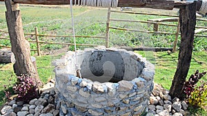
- Stock Photography: WATER-WELL AT VIEWPOINT IN WINTER SEASON AT BAN KHA by Tuayai
- Price: 1$
- Size Facebook: 1702 x 630 px
- Size Twitter: 1500 x 500 px
- Size LinkedIn: 1128 x 191 px
More Facebook, Twitter and LinkedIn Cover Photos
Cover photo info
- Photo title: Water-well at Viewpoint in winter season at Ban Kha
- Author: Tuayai
- Cover photo description:
- Water-well at Viewpoint in winter season at Ban Kha is a district in the western part of Ratchaburi Province, central Thailand. A water well is an excavation or structure created in the ground by digging, driving, boring, or drilling to access groundwater in underground aquifers. The well water is drawn by a pump, or using containers, such as buckets, that are raised mechanically or by hand. Wells can vary greatly in depth, water volume, and water quality. Well water typically contains more minerals in solution than surface water and may require treatment to soften the water. Hand-dug wells are excavations with diameters large enough to accommodate one or more people with shovels digging down to below the water table. They can be lined with laid stones or brick; extending this lining upwards above the ground surface to form a wall around the well serves to reduce both contamination and injuries by falling into the well. Ban Kha (Thai: บ้านคา) is a district (Amphoe) in the western part of Ratchaburi Province, central Thailand. Neighboring districts are (from the north clockwise) Suan Phueng, Chom Bueng and Pak Tho of Ratchaburi Province, and Nong Ya Plong of Phetchaburi Province. To the west is Tanintharyi Division of Myanmar. The important water resource is the Phachi River. On the left shore of the river the Chaloem Phra Kiat Thai Prachan National Park is in process of being established, extending into neighboring Pak Tho district.
- Image ID:48812611
- Views:198
- Downloads:0
Keywords for Facebook, Twitter and LinkedIn timeline photos
aerial
age
agriculture
architecture
art
beautiful
buri
country
countryside
day
environment
famous
farm
field
garden
grass
landscape
meadow
mountain
natural
nature
old
outdoor
park
pond
pool
pulley
pump
ratcha
ratchaburi
ratchathani
retro
rope
rural
scene
scenery
scenic
season
stone
summer
thailand
traditional
travel
village
vintage
water
well
wells
winter
wood
wooden


