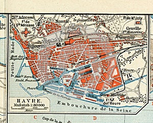
- Stock Photography: OLD MAP OF 1890, THE YEAR WITH THE PLAN OF THE FRENCH CITY OF LE HAVRE. by Aazz1
- Price: 1$
- Size Facebook: 1702 x 630 px
- Size Twitter: 1500 x 500 px
- Size LinkedIn: 1128 x 191 px
More Facebook, Twitter and LinkedIn Cover Photos
Cover photo info
- Photo title: Old map of 1890, the year with the plan of the French city of Le Havre.
- Author: Aazz1
- Cover photo description:
- Original Havre antique city map, colored, dated 1890.Ancient map. Le Havre is a city and commune in Northern France, in the Haute-Normandie region, sub-Prefecture in Department Seine-Maritime. Le Havre port is one of the largest in France. Le Havre is situated on the right Bank of the Seine, near its estuary. The city has direct access to the sea and the English channel. The Seine river separates the city of Le Havre from the lower Normandy region and the neighbouring town of Honfleur. To the North and West of Le Havre is the coast of the Strait of Pas-de-Calais.
- Image ID:68984056
- Views:125
- Downloads:2
Keywords for Facebook, Twitter and LinkedIn timeline photos
1890
aged
ancient
antique
art
atlas
backdrop
background
border
boundary
brown
burned
burnt
canvas
carte
cartography
chart
city
color
continent
country
decorative
direction
dirty
discovery
early
earth
europe
european
find
frame
france
french
geographic
geography
global
grunge
grungy
guide
havre
historic
historical
history
journey
location
manuscript
map
nation
navigate
navigation
old
page
paper
parchment
path
pattern
plan
plane
planning
position
retro
river
road
route
rust
rustic
scheme
stained
street
texture
topography
torn
tour
tourism
travel
vintage
wallpaper
world
worn
year


