- Price: 1$
- Size Facebook: 1702 x 630 px
- Size Twitter: 1500 x 500 px
- Size LinkedIn: 1128 x 191 px
More Facebook, Twitter and LinkedIn Cover Photos
Cover photo info
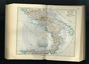
- Photo title: Old map from geographical Atlas 1890 with a fragment of the Apennines, Italian Peninsula. South Italy.
- Author: Aazz1
- Cover photo description:
- Original antique city map, colored, dated 1890. Ancient map. Apennine Peninsula Italian Peninsula is one of the largest peninsulas in Europe, located in the South of the continent and washed by the waters of the Mediterranean sea. On the Peninsula is the main part of Italy and the Republic of San Marino and the theocratic state of Vatican. In the North the Peninsula is limited to the Po valley, on the West by the Tyrrhenian sea, in the East — Adriatic sea, southern Ionian sea.
- Image ID:90022908
- Views:56
- Downloads:3
Keywords for Facebook, Twitter and LinkedIn timeline photos
aged
ancient
antique
apennines
atlas
backdrop
background
border
boundary
brown
burned
burnt
carte
cartography
channel
color
continent
decorative
direction
dirty
discovery
early
earth
europe
european
find
fragment
frame
geographic
geographical
geography
global
grungy
guide
gulf
historic
historical
history
italian
italy
journey
location
manuscript
nation
navigate
navigation
normandy
page
paper
parchment
path
pattern
peninsula
plan
plane
planning
position
retro
river
road
route
rust
rustic
scheme
south
stained
texture
topography
torn
tour
tourism
travel
tyrrhenian
vintage
wallpaper
world
worn


