Login with your Facebook account
Show pre-cropped images
Categories
Nature
Animals
Abstract
Travel
Arts/architecture
Business
Industries
Technology
IT&C
People
Objects
Illustrations & Clipart
You are here:
Home
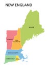
New England Region United States America Political Map (44)
Page
1
2
of
44
results
Sort by:
Relevance
Downloads
Date
Items per page:
20
|
40
|
80
9 50 States United S...
Vermont State Outlin...
Vermont State Outlin...
Detailed Map Us Regi...
United States Census...
Map United States Sp...
United States Divide...
Connecticut Map Dott...
Connecticut Politica...
Rhode Island Ri Poli...
Connecticut Gray Pol...
State Rhode Island P...
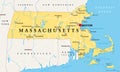
Massachusetts Politi...
Massachusetts Gray P...
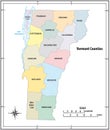
Vermont Vt Political...
New Hampshire Nh Pol...
Maine Me Political M...
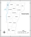
Vermont Vt Gray Poli...
New Hampshire Nh Gra...
Maine Me Gray Politi...
New England Region U...
New England Region C...
New England Region U...
19th Century Map New...
19th Century Map Rho...
19th Century Map Sta...
19th Century Map Sta...
9 50 Sets Us State P...
Vector Map United St...
Highly Detailed Vect...
Highly Detailed Vect...
9 50 States United S...
Regions United State...
New England Division...
New Hampshire State ...
Lake Winnipesaukee M...
New England Region U...
Mid Atlantic Region ...
Mid Atlantic Region ...
New England Region U...
NEXT
x
Sign In